From the north coast of Scotland to the west coast of Wales, these County Lives encompass Caernarvonshire, Cardiganshire, and Carmarthenshire; Caithness, Clackmannan, and Cromarty.
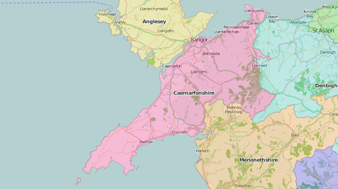
Caernarvonshire on John Speed’s 1610 map is covered in the ‘molehills’ indicating height, as being “altogether mountainous”; “these mountains”, Speed says, “may not unfitly be termed the British Alps”. The later literature of the county makes a feature of them too: Caernarvonshire: a sketch of its history, antiquities, mountains and productions. Intended as a pocket companion to those who make the tour of that county (1792) and: A Guide to the beauties of Anglesey and Carnarvonshire: comprehending particular notices of Beaumaris, Carnarvon, Conway, Snowdon, the Menai Suspension Bridge, Bangor, and every interesting place or object deserving the attention of the tourist (c. 1830). The Early Tourists in Wales site gives hundreds of detailed accounts of Snowdon, including a section of advice from this Guide, and Rev. Nicholas Owen’s night-time ascent.
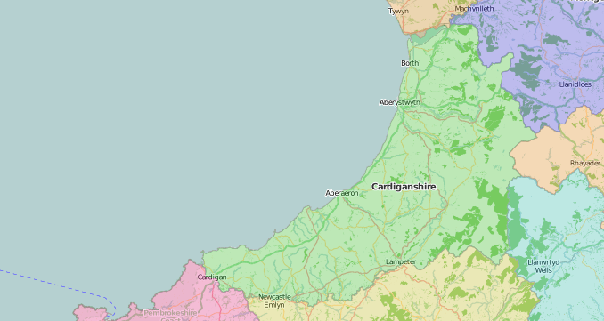
Tudor Cardiganshire appears to be dominated by towering Plinillimon Hill, possibly the least popular mountain in Wales from the evidence of tourist guides such as The Cambrian Directory (1800). Speed also includes “the due forme of the Shiretown”- a neat plan of Cardigan – but nothing for Aberystwyth, despite the town’s importance. Special Collections holds many later works about – and many published in – Aberystwyth, including Thomas Owen Morgan’s New guide to Aberystwyth and its environs; comprising notices, historical and descriptive, of the principal objects of interest in the town and neighbourhood (Aberystwyth, 1858) and the broader Cardiganshire: a personal survey of some of its antiquities… (Aberystwyth, 1903) by Liverpool University alumnus George Eyre Evans (1857-1939), who held major roles in Aberystwyth University, the National Library of Wales, and the antiquarian, or local history, societies of both Cardiganshire and Carmarthenshire.
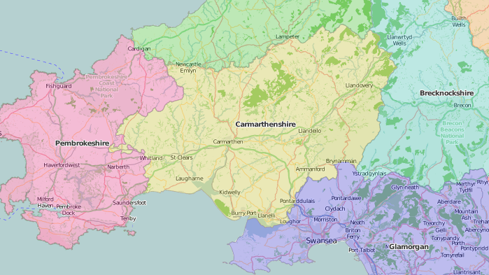
Speed describes Carmarthenshire as “not altogether so pestered with hills as her bordering neighbours are”, and “for victuals … very well stored”. Perhaps the less challenging terrain made time for gentler pursuits such as the poetry of Speed’s contemporary Rhys Prichard (1579-1644). Canwyll y Cymru. The Welshman’s candle, or the divine poems of Mr. Rees Prichard, sometime Vicar of Landovery in Carmarthenshire was translated into English verse by the Rev. William Evans, Vicar of Lanhaden (1771) who may not to be the William Evans whose dictionary was published in the same year: A new English-Welsh dictionary: containing all words necessary for reading an English author; wherein not only the corresponding British is given to the English, … but also every English word is accented to prevent a bad pronunciation (1771)
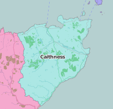
The Scottish book collector John Fraser (1836-1902) came from Wick, and collection reflects his Caithness origins:
Edinburgh Caithness Association, Six songs, composed for the annual dinner of the Edinburgh Caithness Association, 22nd January 1841. By a member of the Committee (1841); Some present-day songs and singers of Caithness (Wick,1899); James Traill Calder (1784-1864), Sketch of the civil and traditional history of Caithness from the tenth century (Wick, 1887); Richard Pococke (1704-1765), The tour of Dr Richard Pococke, Lord Bishop of Ossory, through Sutherland and Caithness in 1760 (Edinburgh: Sutherland Association, 1888).
Richard Pococke was an intrepid traveller and pioneer mountaineer; like his Scottish travels, reaching as far as Orkney, most of his accounts were not published in his lifetime, with the exception of A Description of the East and some other countries (1743-45). His observations were more astute than the title suggests.
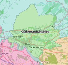
Clackmannanshire, ‘the wee county’ is the Scottish equivalent of Rutland. Clackmannan, the county town, ceded that role to Alloa in 1822 as the port silted up, leaving Clackmannan now more than a mile inland. The General Views series of agricultural reports for the county seems to have found it too little, and extended into the neighbouring counties: General view of the agriculture of the county of Clackmannan; and some of the adjacent parishes, situated in the counties of Perth and Stirling (1795).
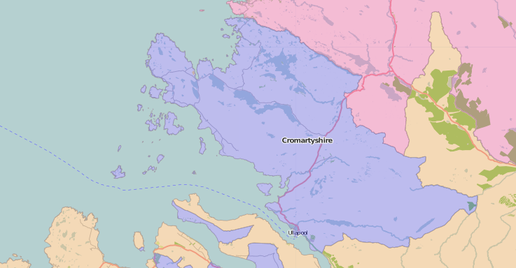
Cromarty, similarly, was covered together with Ross in the General view of the agriculture of the counties of Ross and Cromarty By Sir G.S. Mackenzie, Bart (1813: SPEC Y81.3.526). Cromarty, the county town, remained coastal and the name is familiar worldwide as an area in the shipping forecast. Cromarty was also the birthplace of Hugh Miller (1802-1856), geologist; some of the fossil fishes he excavated from the local sandstone are named after him. His account of growing up in Cromarty, My schools and schoolmasters, 1852 onwards contains detailed descriptions of the area and contributed to his popularization of geology.
Special Collections copies of works cited:
Caernarvonshire
- Caernarvonshire: a sketch of its history, antiquities, mountains and productions (1792: SPEC Y79.2.5)
- A Guide to the beauties of Anglesey and Carnarvonshire: comprehending particular notices of Beaumaris, Carnarvon, Conway, Snowdon, the Menai Suspension Bridge, Bangor, and every interesting place or object deserving the attention of the tourist (Macclesfield, approximately 1830: SPEC Y83.3.665/4)
- The Cambrian directory; or, Cursory sketches of the Welsh territories. With a chart, comprehending at one view, the advisable route, best inns, distances, and objects most worthy of attention (1800: SPEC L4.63)
Cardiganshire
- Thomas Owen Morgan (1799-1878), New guide to Aberystwyth and its environs; comprising notices, historical and descriptive, of the principal objects of interest in the town and neighbourhood (1858: SPEC Y85.3.111)
- George Eyre Evans (1857-1939), Cardiganshire: a personal survey of some of its antiquities, chapels, churches, fonts, plate, and registers (Aberystwyth : Welsh Gazette, 1903: SPEC Y90.3.320)
Carmarthenshire
- Rhys Prichard (1579-1644). Canwyll y Cymru. The Welshman’s candle, or the divine poems of Mr. Rees Prichard … now first translated into English verse (Carmarthen: Printed for the translator by J. Ross, 1771: SPEC Y77.3.530)
- William Evans, A new English-Welsh dictionary (1771: SPEC Y77.3.205)
Caithness
- Edinburgh Caithness Association, Six songs, composed for the annual dinner of the Edinburgh Caithness Association, 22nd January 1841 By a member of the Committee (Edinburgh, 1841: SPEC Fraser 726)
- Some present-day songs and singers of Caithness (Wick: W. Rae, 1899: SPEC Fraser 1676).
- James Traill Calder (1784-1864), Sketch of the civil and traditional history of Caithness from the tenth century (Wick: Rae, 1887: SPEC Fraser 757)
- Richard Pococke (1704-1765), The tour of Dr Richard Pococke, Lord Bishop of Ossory, through Sutherland and Caithness in 1760; with introduction and notes by D.W. Kemp (Edinburgh: Sutherland Association, 1888: SPEC Fraser 1698)
Clackmannan
- General view of the agriculture of the county of Clackmannan; and some of the adjacent parishes, situated in the counties of Perth and Stirling. By John Francis Erskine (1795: SPEC Y79.3.717)
- John Sinclair (1754-1835), The new statistical account of Scotland, by ministers of the respective parishes, under the superintendence of a committee of the Society for the Benefit of the Sons and Daughters of the Clergy (1845: SPEC Y84.3.597)
Cromarty
- General view of the agriculture of the counties of Ross and Cromarty. By Sir G.S. Mackenzie, Bart (1813: SPEC Y81.3.526)
- Hugh Miller, My schools and schoolmasters (undated) JUV.A925
Map of Caernarfonshire from Wikishire.co.uk CC-BY-SA